
Marumori Cycling Festival Long Course
Marumori Town
丸森町役場
Marumori Town Office

The starting point of this course is the Marumori Town office.
- Address
- 宮城県伊具郡丸森町字鳥屋120
![]() 0.6km
0.6km
齋理屋敷
Sairi Yashiki
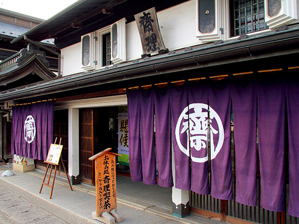
From 1700 to 1900, the businesses of kimono, miso and soy sauce were developed and inherited until the 7th generation. Then the wealthy merchant, Risuke Saito, donated this house which is now open as "Kura no Kyodokan".
- Support
- Information Corner / Parking lot / Bike racks / Bathroom / Water
![]() 3.0km
3.0km
丸森大橋
Marumori Grand Bridge
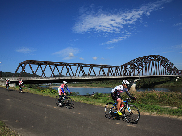
As a newly built bridge, its construction was completed in July 2012. The contrast between Abukuma River and the trees of the riverbed is beautiful.
- Japan National Route 113, Tateyama Bypass
![]() 20.9km
20.9km
松ヶ房ダム
Matsugabo Dam

A dam that flows through Marumori Town in Miyagi Prefecture and Soma City in Fukushima Prefecture. The dam water is mainly used for agricultural purposes in Soma City and Shinchi Town.
- Address
- 宮城県伊具郡丸森町筆甫下南山23-2
![]() 24.1km
24.1km
いなか道の駅やしまや
Yashimaya
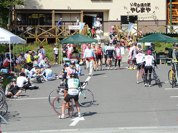
It is a direct sales shop where people can not only buy specialty items of Marumori, but also fresh vegetables and daily necessities. It is also a resting place with a balcony where people can drink tea and have a wonderful view of Abukuma River. Also, on the 2nd floor there is a place to make Hoshigaki (Japanese dried persimmons). In fall, many yellow persimens are lined up there.
- Address
- 宮城県伊具郡丸森町耕野字沼62-1
- Support
- Information Corner / Parking lot / Bike Racks / Bathroom / Water